

Hoddle’s Grid: Street history of Melbourne app for iPhone and iPad
Developer: State Library of Victoria
First release : 02 Apr 2014
App size: 10.86 Mb
A photographic exploration of the history of the streets of Melbourne.
Hoddle’s Grid gives you a unique perspective of Melbourne’s central business district through the history of the buildings and streets in photographs and pictures.
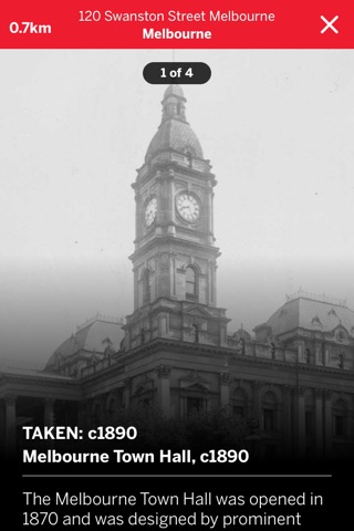
The State Library of Victoria presents hundreds of photographs and pictures from the Library’s collection to cast a new light on an old city, and show you a grand old Melbourne in all its glory against the Melbourne of today. Hoddle’s Grid was created by and named after Robert Hoddle (1794–1881), a senior surveyor in the 1830s who mapped the central grid layout of the streets in the centre of Melbourne.
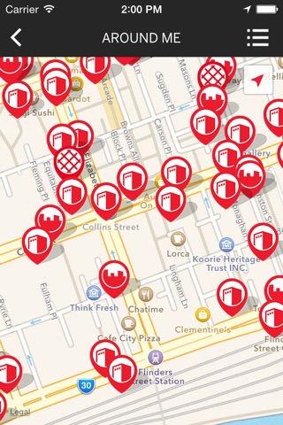
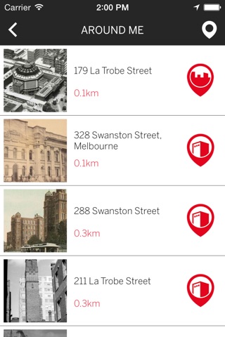
Select or search for a destination you wish to explore or use ‘Around me’ and your GPS to locate the mapped images closest to you. Want to know more? Every address provides insight to historical facts at a tap. Use Hoddle’s Grid to create your walks through the Melbourne of today with an insight of yesteryear – either before you arrive or when you are in midst of Melbourne’s central business district.
The app features:
• Hundreds of photographs and images from 19th and 20th century Melbourne
• Fascinating stories and snippets of the history of the buildings, streets and aerial views
• 150+ addresses mapped across the city grid of Melbourne
Take part in our challenges to hunt down the locations that match the Mystery Photo checkpoints!
Want to continue your journey through Melbourne’s history? Visit the State Library of Victoria to peruse our collections and enjoy our wonderful exhibitions of Victoria’s history. Or join us online to delve into our digitised collection of 300,000+ photos and images at www.slv.vic.gov.au